

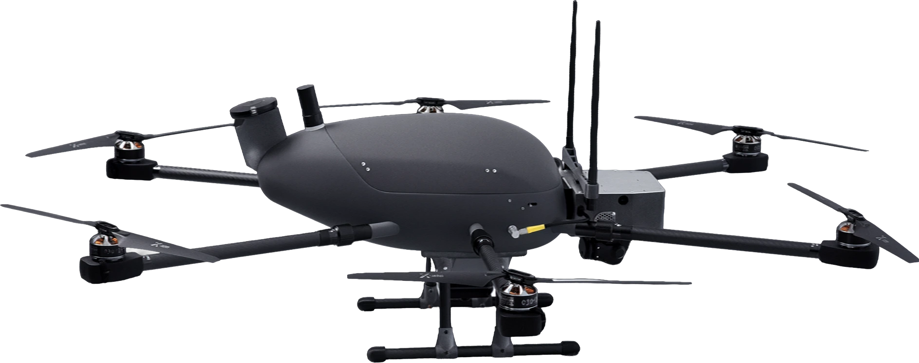
Video ISTAR UAV
A versatile multirotor UAV with extended flight performance.
Typical operational roles for the Beetle are video ISTAR and signal relay for FPV drones and secure communications systems. It is most effective in scenarios where vertical takeoff and landing are required while the survey area is relatively small.
Typical operational roles for the Beetle are video ISTAR and signal relay for FPV drones and secure communications systems. It is most effective in scenarios where vertical takeoff and landing are required while the survey area is relatively small.
up to 12 km
Controlled radius range
60 min
Max endurance
1000 m
Max altitude
1,8 kg
Payload capacity
7,8 kg
Max takeoff weight
1,15 m
Width
25 min
Deployment time
40 km
Max flight distance
70 km/h
Max speed
1,05 m
Length
VTOL
Launch method
Key Capabilities

Secure Communication
The aircraft is equipped with anti-jamming GNSS, video communication and telemetry transmission systems, ensuring resilient and uninterrupted data exchange.

Tactical Signal Relay
The UAV provides secure connectivity in denied or infrastructure-limited environments, operating as an airborne communication hub.

VTOL Capability
Beetle allows vertical take-off and landing without the need for additional equipment, enabling rapid deployment and simplifying field logistics.
Payloads
SONY LR1
- EO Zoom Depends on lens
- Clear Image Zoom: up to 2x
- EO Resolution 9504 × 6336 px
- Equivalent focal length 21…70 mm
- Image resolution (GSD) 1…10 cm

NextVision X80
- EO Zoom 80x visual zoom (40x optical 2x digital)
- EO Resolution 1280 x 720 px
- DRI 25 / 12 / 6 km


Operational Advantage for Short-Range Reconnaissance
Designed for space-constrained missions, the Beetle is a compact UAV that provides effective short-range reconnaissance and secure signal relay. Its VTOL design enhances operational efficiency without requiring large launch areas.
What’s Included
UAV Beetle comprising:
- automatic flight controller,
- power plant,
- onboard navigation system,
- NextVision X80 camera (day: 1280×720, 40x/2x zoom) on a gimbal with camera controller,
- video link kit,
- set of rechargeable batteries (3 pcs),
- battery charger,
- GPS tracker,
- transport case.
2
Ground workstation with remote monitoring and control system, licensed for the use of IRIZI Focus-V software, which provides AI-based video stream analysis, target transfer to GIS, and restreaming of the feed to other systems.
1
Hardware-software multi-frequency, multi-system onboard GNSS receiver Shaper X5.
2
Ground antenna system with a jamming-resistant remote control and telemetry system.
1
